Click here
to go to Sankaty's home page
Vector Chart
with
coordinates for outer channel marker
and track used by a 6' draft boat
Lighted G11 not shown

Zoomed In Raster chart
includes all five sets of coordinates
for the private marks Lighted G11 not shown.

Zoomed Out Raster chart
Sawyer Harbor to Little Sturgeon Bay

  topographical map

Highway map

Checkout the six foot contour line in Sand Bay as in one spot it needs to go out at least 500 feet to the north and north east.  click here
Wave Pointe Marina   Carmody Boat Launch
Little Sturgeon Bay, Wisconsin
This page was last updated: January 4, 2017
This page was created  January 23, 2003
full vector chart in jpg

full vector chart in GIF
email me
The  Carmody Boat Launch was finished in 2005
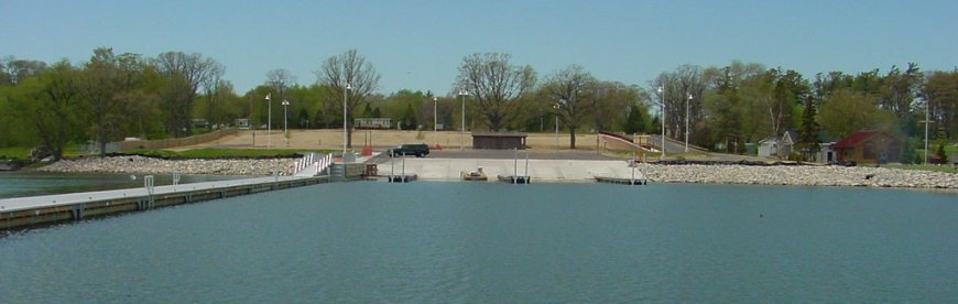
capable of launching six boats at a time from trailers and a 360 foot long pier to protect the area from south and southeast winds. This picture was taken early in the spring of 2007, and the 360 foot long floating pier was drawn in by hand as it was still in the parking lot.  The parking lot fills up very early on nice days and folks often park on the grass, some times in the shadow of mature trees.  The Parking lot annex construction started in the summer of 07' across from the current parking lot on County highway CC.  The area north of the 360 foot long floating dock is roughly 8 feet deep when measured with my boat's depth meter.

the above, 2007 Photo is Courtesy of Door County Land Information Department
Carmody Boat Launch looking West
from far east end of 360' "L" dock near G13.
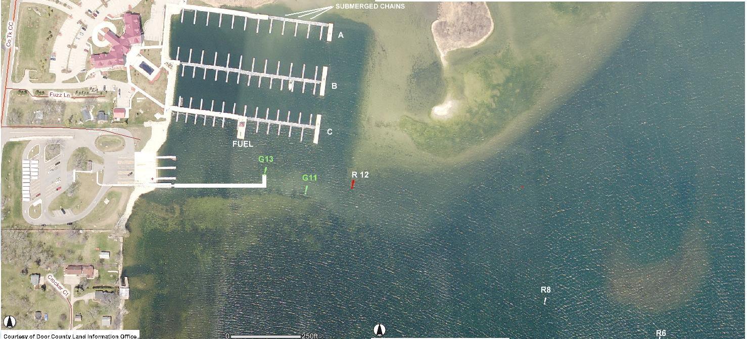
NOTE: The above April 2007, photo has been altered to show the buoys, submerged chains, 360' Carmody "L" dock, the Wave Pointe fuel dock, and the Wave Pointe dock designations.