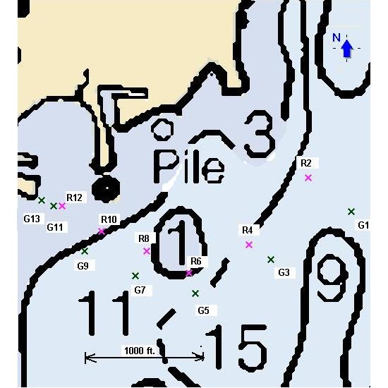
Coordinates as of July 07


       R2                   G1                            R10                 G9
        ?                         ?                   N 44 50.597     N 44 50.567  
        ?                         ?                  W 87 33.350    W 87 33.389 

       R4                   G3                           R12                 G11
N 44  50.578      N 44 50.556              N 44 50.626     N 44 50.621  
W 87 33.036     W 87 32.986             W 87 33.417    W 87 33.458 

       R6                     G5                                              G13 
N 44  50.536       N 44 50.503                                    N 44 50.634
W 87 33.161      W 87 33.147                                   W 87 33.494'

        R8                  G7                                 
N 44  50.566      N  44 50.529                
W 87 33.251      W 87 33.277               
 
All buoys need to be verified except G13  (July 07)
Click here to return to
Wave Pointe Marina
Chart and Map selection page

This page was last updated: January 4, 2017
Raster Chart
from Maptech.com

.Click here to return to
Wave Pointe Marina
Chart and Map selection page

Caution,
buoy numbering may not be same as what is on the buoys.
A lighted marker G13 was added in 2005 as well as an additional set of buoys at entrance.
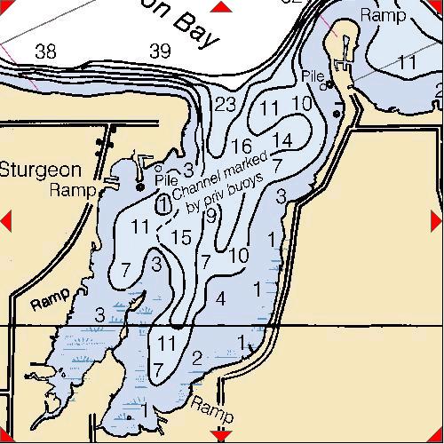
There are now six sets of red and green buoys as well as the extra green one on the end of the pier.
I'll get the coordinates of the new ones later this year.  The one on the end of the Carmody Boat Launch Piere is N44 50.634' W087 33.494'