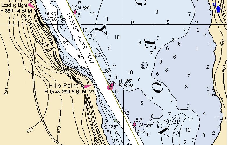
The line from Red nun number 24 to Red nun number 26 is not forgiving and it is best to give it generous room. eg Use R26 and R28 as a range as it will keep you to the south east. The line is drawn in but not labeled. The Edition 24 version of the 14919 chart places the R24 and R25 buoys at their GPS coordinates creating a whole new set of issues for this chart.
So far I find that the GPS's that I have are accurate to +/- 15 feet when they have 3D nav. I tested this on several Geodetic Marks so I am pretty confident of the GPS accuracy, but the chart accuracy for chart 14919 often 120 feet to the soutwest. That is the GPS readings will plot 120 feet north east of the item on the chart.
This page was last updated: January 4, 2017
Created June 25, 2003